Geographic Information Systems (GIS) Applications in
Transportation Systems Engineering and Planning
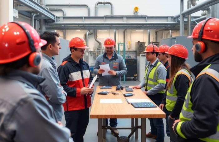
Using GIS in Traffic and Transport Infrastructure Solutions
Using GIS in Traffic and Transport Infrastructure Solutions
The Geographic Information System (GIS) Applications in Transportation Systems Engineering and Planning training course provides a thorough introduction to the fundamentals of GIS, focusing on transportation infrastructure and road safety data collection, as well as analytical methodologies and techniques using GIS.
In many developed countries, authorities actively use GIS for highway and transport management, driven by the advantages of reduced costs and increased efficiency in planning, monitoring, and managing complex transportation systems. GIS tools are particularly valuable for tasks such as transportation planning, accident analysis, and route optimization.
GIS techniques play a key role in identifying capacity improvements, optimizing operations, and making strategic investments to ensure the transportation system operates efficiently. This training course not only covers the technical aspects of GIS use but also emphasizes the development of spatial thinking and decision-making skills.
Key topics in this Energy Training Centre training course include:
By the end of the Geographic Information Systems (GIS) Applications in Transportation Systems Engineering and Planning training course, participants will be able to:
In this training course, the instructor will present the topics using a range of effective adult learning techniques, with an emphasis on case studies and best practices. The training course will feature active participation, in-class practice cases, engaging group sessions, video materials, and interactive tabletop activities.
This Geographic Information System (GIS) Applications in Transportation Systems Engineering and Planning training course is ideal for a wide range of professionals, particularly those involved in traffic and transportation engineering, road infrastructure and safety, urban planning, and traffic management centers.
This training course will be especially beneficial for:
By attending this training course, participants will develop essential professional and technical skills that improve workplace performance, enhance operational effectiveness, and support long-term career growth.

After successfully completing this training course, participants will be awarded The Energy Training Centre Certificate of Completion — a respected validation of their dedication to continuous learning and professional excellence. This certificate signifies that participants have gained the essential knowledge and skills required to make a measurable impact in their field.
The Energy Training Centre is registered with NASBA as a sponsor of Continuing Professional Education (CPE) on the National Registry of CPE Sponsors. Because of the rigorous processes and standards required for NASBA approval, many professional boards and associations accept CPE training course credits earned from NASBA-registered sponsors. Only learning providers committed to offering high-quality continuing education programs that improve professionals’ competence are accepted by NASBA. The Energy Training Centre is proud that all training courses within our portfolio are currently approved by NASBA.
These NASBA-approved training courses are delivered by leading experts to meet global demands and are dedicated to enabling professionals to achieve competencies that drive business results.
By choosing The Energy Training Centre NASBA-approved training courses, participants will:
We offer a variety of training delivery formats to suit your needs. Courses can be delivered in the classroom or online. Large groups can opt for an in-house solution, allowing customization based on specific requirements.
Yes, we do. We provide tailored training courses designed to meet the specific requirement of larger group of individuals. These customized training courses can be conducted both classroom and online formats, allowing you the flexibility to choose you preferred dates and duration.
Please contact us at [email protected] to discuss your group’s training needs, and we’ll work with you to create a personalized training course that aligns with your objectives.
Yes, special discounts are available upon request if you have more than one registrant for a course. For further information please email us at [email protected]
We offer two convenient payment options:
Upon receiving your registration details, either via email at [email protected] or through our online registration form, we will send you the following by email within 24-48 hours of registration.
There are two convenient options to register for a training course:
We understand that time zones may be different between our Senior Consultants and our delegates. Our standard online course timings (11:00 AM to 4:00 PM, GMT+4 – Dubai, UAE) may be adjusted upon confirming the programme. Our team shall communicate between the confirmed registered delegates and suggest a suitable course timing for all.
Our standard course duration for our classroom programmes is 6 hours per day while our online session is 5 hours per day.
Our training courses span across diverse industries, encompassing sectors such as but not limited to:
Our commitment lies in continuously refining and expanding our training course offerings to align with evolving industry landscapes. We encourage individuals to explore our website or engage with our dedicated support team for the latest information on available courses, ensuring access to the most pertinent and current educational resources.
Yes, The Energy Training Centre is certified and recognized by several prominent industry standards. Specifically, it holds certifications from ILM, Continuing Professional Development (CPD), and the Project Management Institute (PMI).
These certifications underscore our dedication to providing high-quality, industry-relevant training that fosters professional growth and meets established standards. Additionally, we are actively pursuing further certifications and affiliations to enhance our offerings and ensure we remain at the forefront of industry best practices.
Energy Training Centre is a leading provider of professional development programs for the energy and public sectors. With over 15 years of experience, we have trained more than 50,000 professionals across the Middle East and beyond.
Our expert-led courses are designed to meet the evolving needs of modern organizations, combining theoretical knowledge with practical applications that deliver immediate value to your career and organization.
We partner with leading institutions to deliver world-class training programs
Real feedback from professionals who completed this course
The instructor has an amazing way of delivering the topic to those without a specialist background.
This training course gave me a more and bigger perspective about design thinking how to implement it and improve my personal and professional life. It is a privilege to be taught by our Senior Consultant.
This was the best instructor I have met in these (Oil & Gas) trainings.
Amazing sessions with the Senior Consultant. Truly insightful and a week well spent getting new knowledge.
The presentation and delivery was excellently done. I was able to understand the basics of trading beyond my expectation. This is solely due to the good teaching method of the Senior Consultant.
The Senior Consultant did an excellent job in presenting the material and bringing real life case studies and examples during the classroom discussion.
This was a beneficial training course, and I was glad to receive a lot of valuable information.
This was really an amazing training course and I learned everything to enhance our system.
The Energy Training Centre Senior Consultant has excellent knowledge of the subject area. His teaching methods made the concept of ORM easy to understand and follow. Overall, excellent training course.
This training course had a very good introduction into operational risk management.
I enjoyed this training course with the guidance of The Energy Training Centre Senior Consultant. He has excellent skills in delivering and presenting the training course and very knowledgeable about the subject. He supports by answering any questions and links it to practice. Additionally, he provides examples to explain and clarify as well as simplify the subject. I would really recommend attending this training course.
The Power System Protection training course was very informative and the facilitator has a great wealth of experience in this area which made the explanations very easy to understand. He runs through the basics and breaks down the complex parts of the power protection systems. It was a rewarding engagement signing up for this training course.
Great and very rich training course content. The instructor was very professional and has great experience in pipeline.
The training course has provided very good illustrations for the topics discussed. The sessions were filled with energy and exciting lectures. I now have a better understanding of contacts through educational sessions, especially in our breakout sessions on contract negotiations. Overall, this has been one of my best training courses so far. Well done!
The Energy Training Centre's senior consultant has rich experience about the Oil & Gas industry which helped us. Sessions were very useful. Thanks a lot for for sharing valuable information.
The refining operations sessions were highly practical and relevant to the Nigerian context. They were very thought-provoking, highlighting what is needed to make petrochemical plants successful in Nigeria and deliver greater value.
The training course is well taught and structured. The knowledge, exposure and solutions are insightful in advising and helping the company and country to diversify the economy.
Highly valuable content and engaging delivery.
Very good training course and excellent presenter.
Great delivery, great facilitator, carried everyone along and always ensured delegates understand the topics taught.
The practical exercises were important to improve learning.
Very great and useful training course.
The training course was very valuable and fruitful. The Senior Consultant was really an amazing instructor.
Great training course. Great instructor and training location.
This is a great and excellent training. Thank you to the instructor for the well-delivered lectures.
Excellent training! Very professional and knowledgeable instructor. Everything was clear and presented in a very clear and interesting way. It has been a really great experience and the training course was delivered in a relaxing and nice environment.
The training course was really great, and I gained a lot of valuable information from the Energy Training Centre instructor. The training course content was enriching and enjoyable. Thank you all.
The Energy Training Centre's Senior Consultant comes with a wealth of knowledge!
The training course is amazing in all aspects, material wise and even time distribution. I wish everyone to go through this training course.
I try to not exaggerate my ratings, but this has really been an exceptional training course. Should be marketed towards senior leaders and executives in EGA.
Great presentation and material.
Very useful day. Good instructor and professional presentation. The facilitator was fantastic and on top of the job. His delivery was on point.
Had a lot of workshop activities and this made the training more practical and interesting. I really enjoyed the training. He gave more practical workshop demonstrations, on worksite safety practices (IOSH) and power generation processes. Very useful exercises. Additional knowledge acquired and very useful training. He is the perfect instructor.
The course and instructor were very informative and this will greatly help me in my job
Very good course and very interesting
The presenter is amazing, he knows how to keep the audience engaged and his information of the topic is excellent.
Very good course and very informative. The integration between energy, politics & economics well explained.
I really enjoyed this course, it was extremely benefiting. Moreover, we had a great instructor and an amazing teacher. To be honest, this is the best training I have ever attended.
The course provided significant insight to energy contracts.
The presenter understands us and has in depth knowledge of the topic and he chose the most appropriate examples to demonstrate it.
The programme has equipped me with the necessary tools to develop our interventions in the capacitation of energy markets and pricing regimes. Objectives met.
Today's session was an interesting and very useful introduction to the modules in production practices. Energy Training Centre Instructor taught in a lucid, chronological and helpful way. Looking forward to tomorrow’s session.
I was in a relax mood & environment. I am very much satisfied with this course. Well done Energy Training! I enjoyed every moment of this course, it was interactive in nature and we had an easy discussion.
The course was very fruitful and valuable to improve our leadership skills, in both life and work aspects. The instructor had significant positive influence to add up lots of great insights to this course subject.
The course is educative and has exposed me to the new trend in power system.
The consultant is knowledgeable and intelligent. The course material is also well written for easy understanding, also used a lot of practical example to deliver his point.
Learnt a lot today, especially the discussion on environmental and social impact.
I wish the training wouldn’t end because the trainer was very knowledgeable. I can’t wait to go back to my workplace and implement what I’ve learned.
The training program was well organized and executed. Energy Training’s willingness to assist us with any of our concerns was awesome. Great job!
The training is quite informative and interactive. Also, the venue is very conducive for learning.
Brilliant course and intelligent consultant.
The training was really perfect and informative as we gained a lot of new informations related to my field and work environment. Thanks a lot to the instructor for the efforts and skills which passed to us as well as special thanks to the coordinator which is really supportive and spent most of her time to be friendly & helpful. Very good course and orgnization. Well done!
The instructor is best lecturer and presenter. I was learning everyday and we shared our experiences so thank you very much Energy Training. I will encourage my colleagues to participate in future seminars organized by Energy Training and suggest it to anyone who are in search of training/seminar.
Your growth starts here. Discover the complete portfolio of industry-leading training courses that can help you achieve your career goals.
View Course FinderFirst Floor Incubator Building Masdar City
P.O. Box: 135116, Abu Dhabi, UAE
130 Old St., EC1V 9BD London, England